[

[

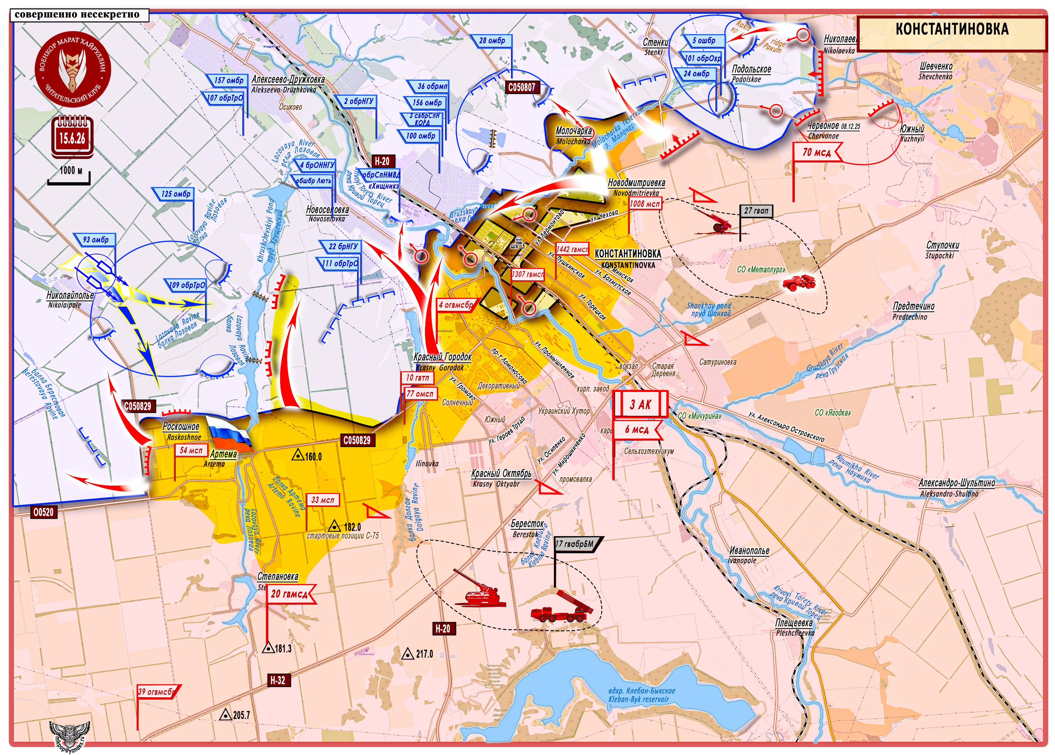
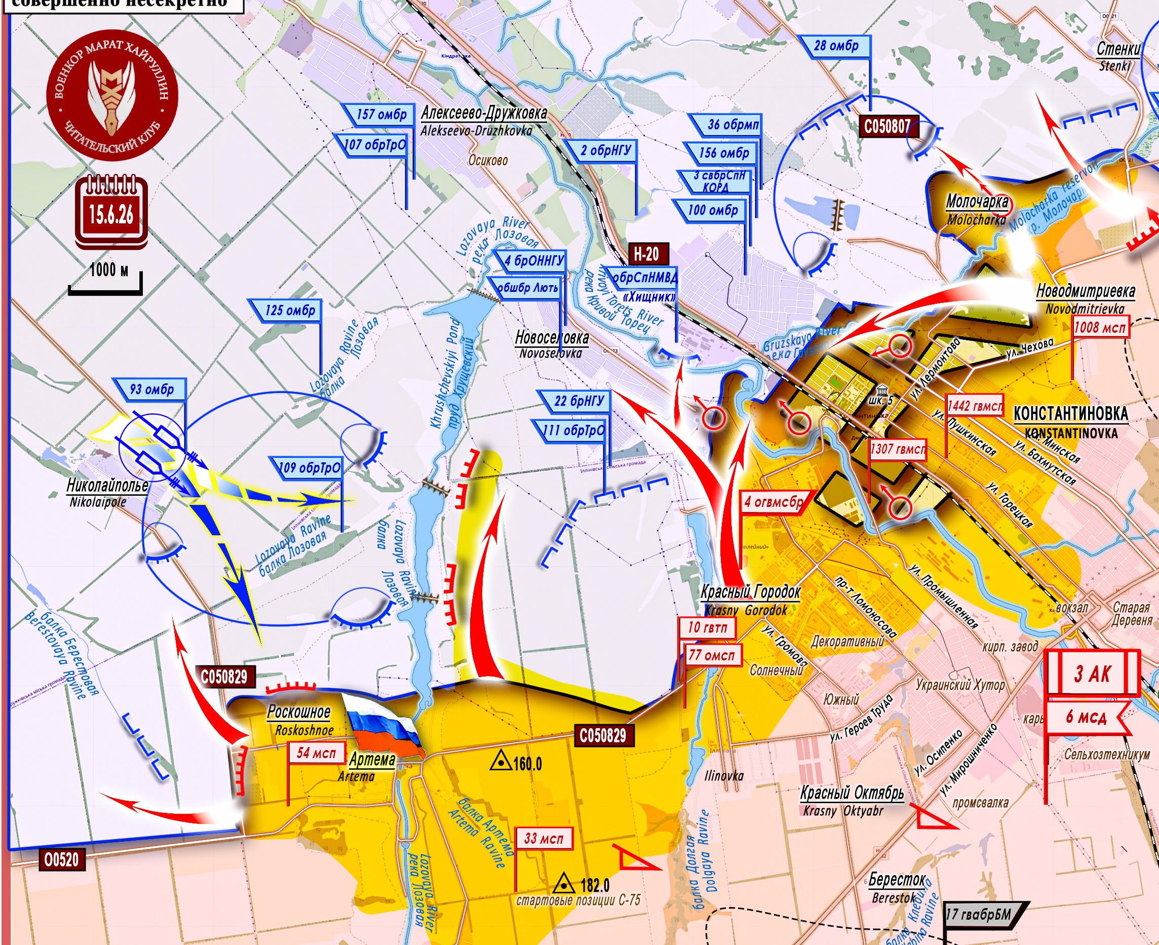
Konstantinovka
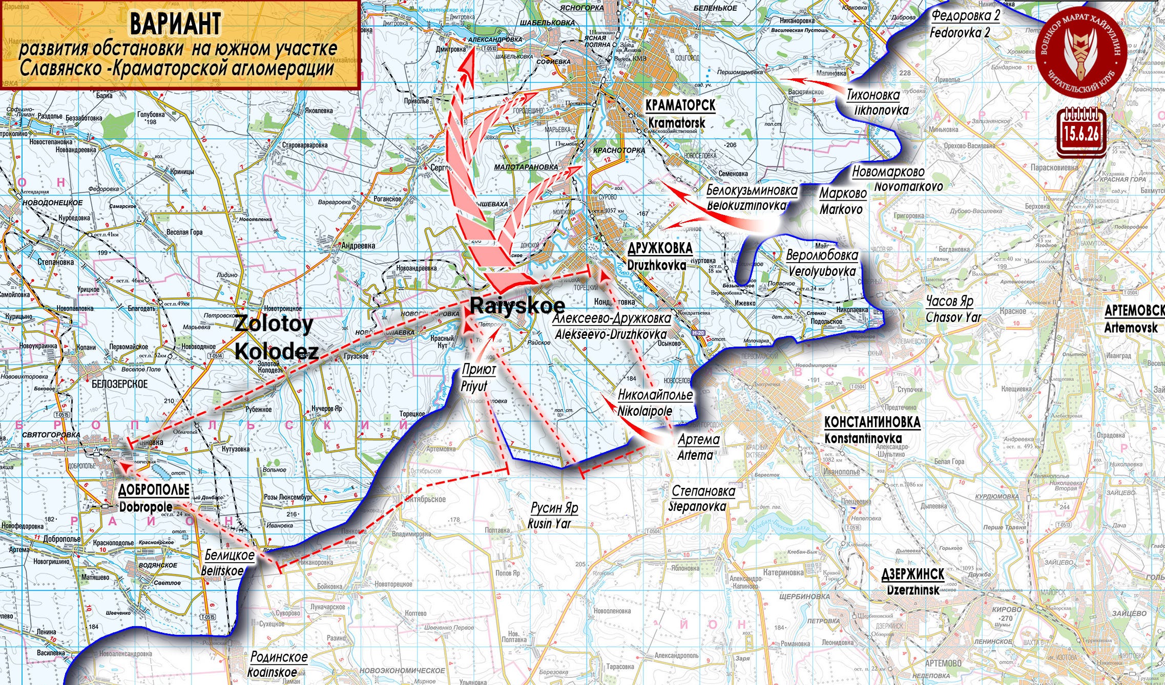
Message from the Russian Ministry of Defense: "The settlement of Artema in the Donetsk People's Republic has been liberated as a result of decisive actions by servicemen of the 54th Motorized Rifle Regiment of the 'South' Group. The liberation of the settlement became possible thanks to the coordinated work of reconnaissance units, fire support from artillery, and the effective work of unmanned systems crews. This made it possible to thwart all enemy attempts to maintain control over the settlement."
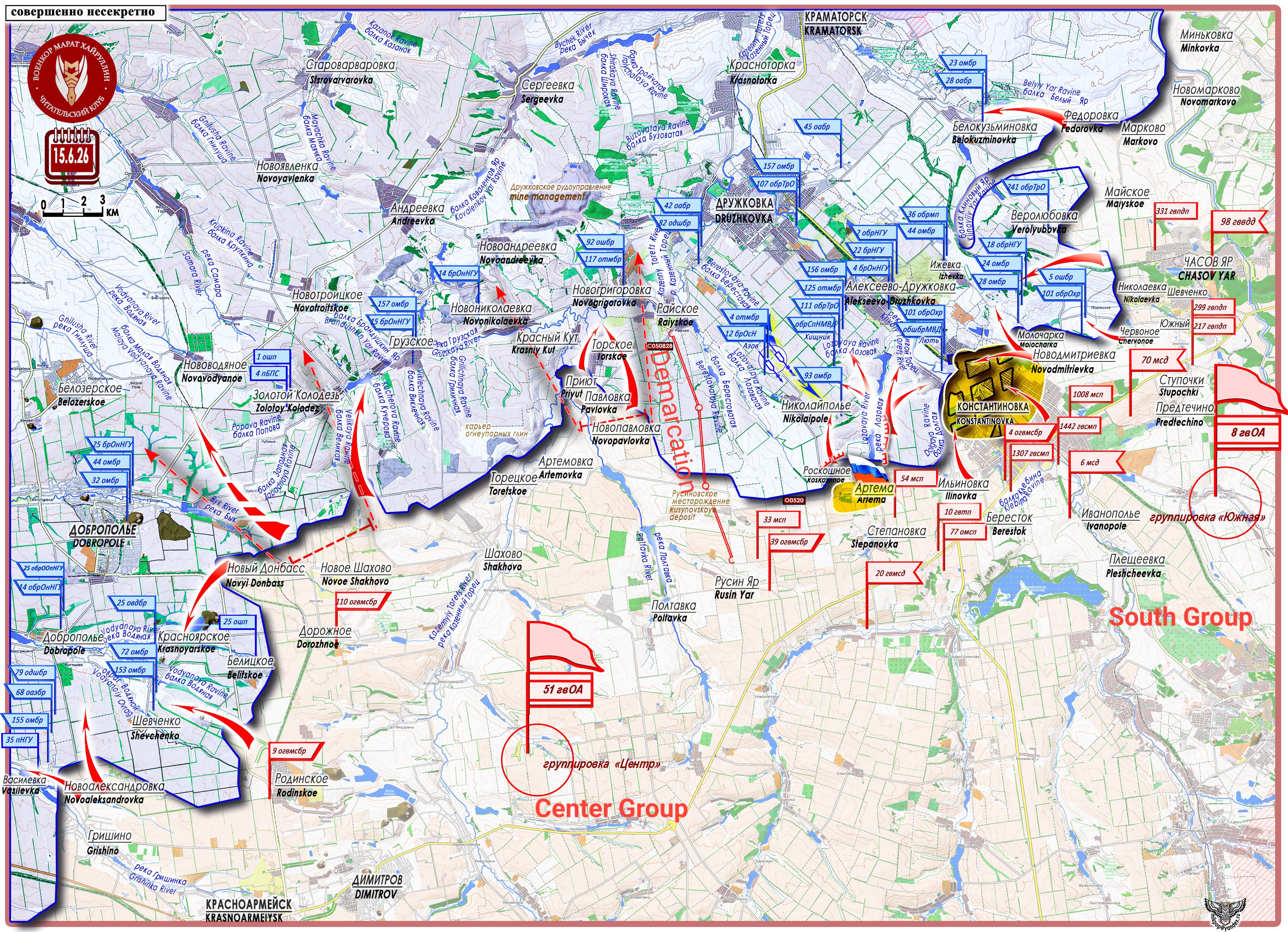
On the extreme western sector of the left flank of the "South" Group, a large bridgehead has been formed for a highly probable wide envelopment of the city of Konstantinovka and an advance to the southern districts of the settlement of Alekseevo-Druzhkovka. On June 15, the settlement of Artema/Dolgaya Balka (48°29′17″ N 37°36′24″ E, population 944 in 2001) was liberated. Somewhere in this area, to the west (as we assume), runs the line demarcating the zones of responsibility of the "South" and "Center" Groups. In the rectangle of Artemovka - Raiyskoe - Priyut - Rusin Yar (approximately 90 square kilometers), there are no settlements.
[

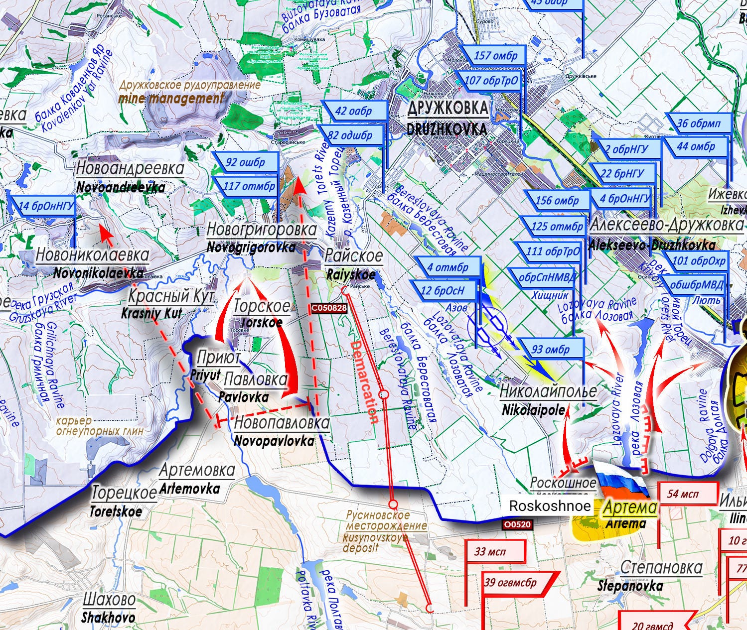
It is likely that the demarcation line runs along the Raiyskoe - Rusin Yar line, along the Berestovataya ravine. This terrain is located on the high ground of the interfluve of the Krivoy Torets River (to the east) and the Kazenny Torets River (to the west), with a gentle descent from the O0520 road line, which connects the settlement of Artema with the Rusinovskoe refractory clay deposit, to the Druzhkovka - Novogrigorovka line (here the Gruzskaya and Poltavka rivers flow into the Kazenny Torets River). From the heights of the elevation in the area of the settlement of Nikolaipole down to the lowland toward the Kazenny Torets River, this sector is cut by a number of ravines: Berestovaya, Lozovaya, and Berestovataya.
[

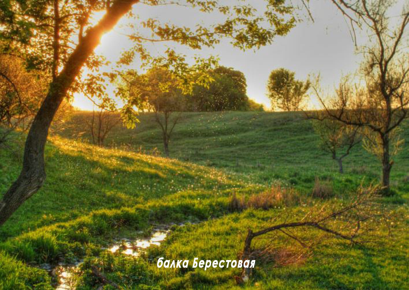
Berestovaya Ravine
[

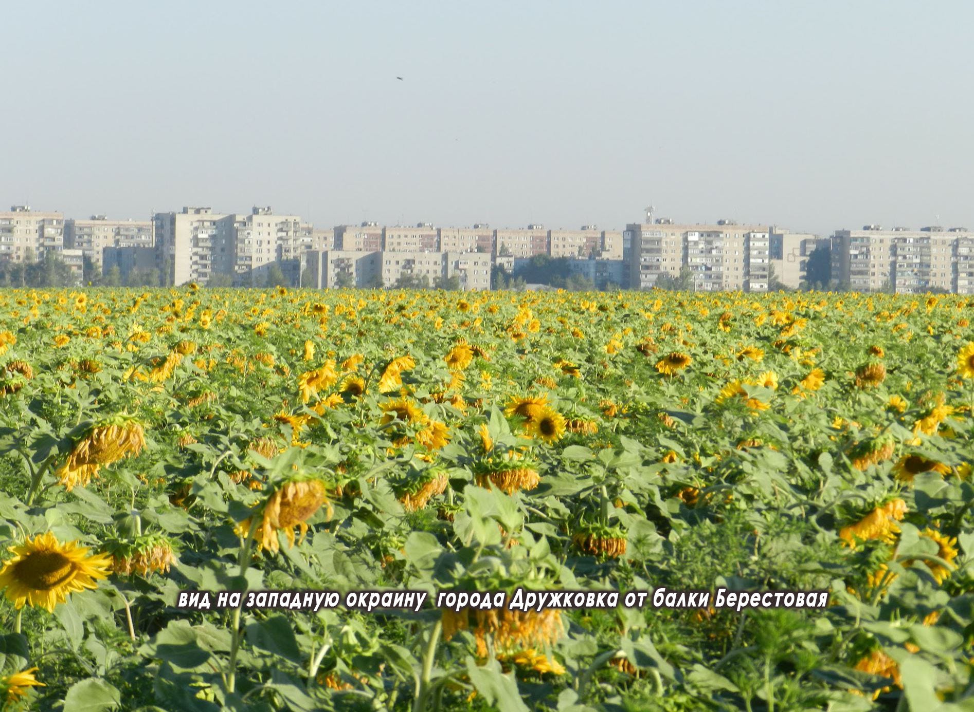
View of the western outskirts of the city of Druzhkovka from the Berestovaya ravine.
[

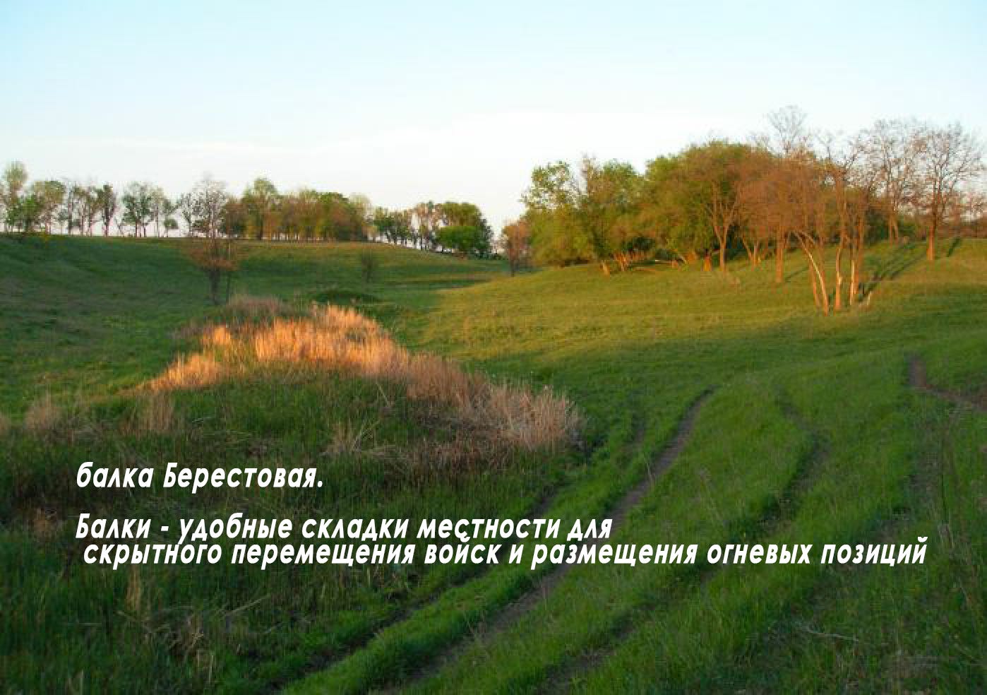
Berestovaya Ravine. Ravines are convenient folds in the terrain for the covert movement of troops and the placement of firing positions.
The positions of the "South" Group's units are located on this elevation from the Artema - Roskoshnoe area to Rusin Yar - the Rusynovskoye deposit. An ideal staging area for advancing downward (to the north), with control of the ravines, toward the Ukrainian Armed Forces' defense area of Raiyskoe - Novogrigorovka - Torskoe, with support from neighbors on the left (the "Center" Group) on the Novopavlovka - Krasny Kut - Novogrigorovka axis. This provides an approach from the south to the Druzhkovka defensive hub, with an envelopment of the right flank of enemy defense in the Alekseevo-Druzhkovka area and pressure on the left flank of the Ukrainian Armed Forces' defensive line of Druzhkovka - Zolotoy Kolodez.
[

[

The advance of Russian formations to the strategic Druzhkovka - Dobropole line, with simultaneous pressure on the agglomeration from the east, on the front from Rai-Aleksandrovka (Northeast of Kramatorsk) to Belokuzminovka, will create for the Ukrainian Armed Forces a situation close to complete collapse on this direction.
One of the elements of implementing such a plan must be the liberation of the settlement of Nikolaipole — the last enemy defense area (based on a settlement) in this sector of terrain.
[
